
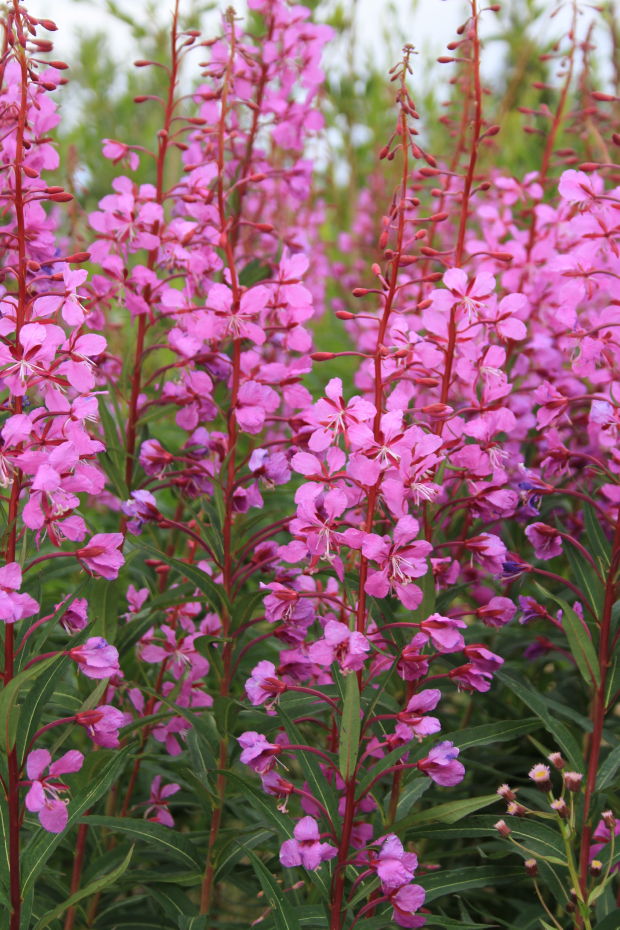
Clear skies, clean air, and pure waters, as well as the
Yukon vegetation, are symbolic of the environment here.
 |
| The USA /Alaskan Border lies ahead. |
With this entry I am returning to blogging about our summer Alaskan adventure. You may remember I had forewarned you that there would be a break, but I would resume the blog in the fall. I am fulfilling that now with this entry.
There are multiple blogs remaining to cover our 90 day trek from
Arkansas to Alaska and back. This specific blog documents the final days as we
approached the Alaskan border for the first time.
I will indicate the actual dates as I describe our travel activities. My recall of the events will be based on the
daily journals we kept for this adventure.  Historic milepost markers have been installed to
identify sites that are related to the construction of the highway in 1942-43.
These spots mark the location of construction camps, army bases, airfields, and
telegraph stations.
Historic milepost markers have been installed to
identify sites that are related to the construction of the highway in 1942-43.
These spots mark the location of construction camps, army bases, airfields, and
telegraph stations.

We are getting closer!
Daisy and I called this journey the Ultimate
Road Trip. We charted our own course each day, stopping and going whenever and
wherever we wanted. We had to learn a few things concerning weights and measures in order to make out travels easier here in Canada. We did not want to under calculate fuel, bridge clearances, and mileages. So its a good thing Dr Daisy was riding shotgun with the smartphone app.
Converting from our system of measurement to metric is
easier than you might think:
·
Multiply miles by 1.6 to get kilometers;
·
Multiply feet by .3 to get meters;
·
Multiply gallons by 3.7 to get liters;
·
Multiply
pounds by .45 to get kilograms;
·
Subtract 32 from Fahrenheit degrees then
multiply by 5/9ths for Celsius;
·
Multiply Canadian $ by .92 to get US $ (on
average at the time we were there).
The Yukon section of the Alaska Highway on which we traveled is part of the Rocky Mountain
route to Alaska and featured breathtaking panoramas of mountains, lakes,
waterfalls, tunnels, trestles, and historic sites. Being a forester, I was intrigued by the common vegetation we encountered.
 |
| Trembling Aspen |
 |
| Black Spruce |
The route between Laird River and Watson Lake
crosses back and forth between British Columbia and the Yukon Territory (YT) several
times. We only had to travel 130 miles between these points to reach our next overnight
destination.

One highlight was a black bear, with a bad fur day, that was minding its own business and wishing the tourists would do the same. We saw three black bears this morning.
One highlight was a black bear, with a bad fur day, that was minding its own business and wishing the tourists would do the same. We saw three black bears this morning.
Tuesday, June 17
Watson Lake, YT
Elevation 2,293’, 66° when we arrived
Road miles this day 130
Watson Lake is located in the rolling hills of the southeast Yukon. It is a major service area for tourism and is also called the “Gateway to the Yukon.”

We arrived there in late morning, found a bank
to exchange US dollars for Canadian currency, and went to the visitor’s center
as we normally do in a new area. We decided to go to the Sign Post Forest,
Northern Lights Centre, a grocery store (for local beer as well as food items),
and an eatery.
This town is noted for hosting the famous Sign Post
Forest. This attraction was started in 1942 by a homesick U.S. Army G.I. While
working on the Alaskan Highway, Carl Lindley of Danville, IL erected a sign
stating the mileage and pointing the way to his hometown. Other soldiers and
construction workers followed his lead, and later many tourists did as well.
 |
| I don't know why I was sucking on my tongue! |
 |
| There is room here for your sign too. |
Today there are over 77,000 signs posted, including one from us. The town of Watson Lake maintains the site and erects more posts as needed.
 |
| One day someone will tell us they saw our sign. |
We camped at the Downtown RV Park for $38 Canadian.

 |
| Campground is basically a large gravel parking lot with hookups. |
It was there that we met a couple from San Antonio who were traveling
with a large RV caravan. We were traveling in the same direction with planned
stops in the same places! Based on the caravan’s schedule, we adjusted our
overnight stays to avoid possible conflicts at the campgrounds along the
way. Rarely did we make reservations in
advance. We never had a problem finding
a place to spend the night.

The Northern Lights Centre is a 100-seat theater with reclining chairs and a ceiling that is the screen. It features a multimedia northern lights show featuring one film on the Aurora Borealis and another on black holes in space. The only distraction I had was two old guys who snored loudly during the presentation.
It was a drizzly day. We did not run around in the evening here. We
previously spent a couple of days without internet and cell coverage. So this night we decided to catch up with
email/Facebook and take long hot showers in the bathhouse. Showers are important when two people live in
less than 100 square feet.
June 18 55°
Clear and sunny
168 road miles this day
After leaving Watson Lake, we began to encounter frequent road reconstruction due to frost heaves caused by permafrost conditions.

The first instance was 7 miles of an under reconstruction, shared, one lane, dusty gravel road. We motored at 10-30 mph, often slowing down and stopping for construction vehicles that had the right of way.


This was an indication of things to come. The positive thing about this
slower travel was the great views we had that even I as the driver got to
enjoy.

June 18
Teslin, YT
2,244’, 55°
Road miles this day 168
The road from Watson Lake to Teslin flows through lush river valleys and crosses several low mountain passes. Teslin is a small village of 460 people at milepost 804 on the Alaska Highway.
 |
| The road to Teslin |
The road from Watson Lake to Teslin flows through lush river valleys and crosses several low mountain passes. Teslin is a small village of 460 people at milepost 804 on the Alaska Highway.
 |
| Are they real? |
Teslin is taken from the Tlingit word Teslintoo, meaning
“long narrow water.” The lake is 92 miles long, so the name fits well, and is
crossed by the longest steel bridge span on the entire Alaska Highway.

 At the Rancheria Falls rest area, we stopped and took a
short trail hike to a small waterfall. I would have liked to have fished for
Dolly Varden and Graying here, but I did not have a license. We decided not to
take the time to get a Yukon license on this trip.
At the Rancheria Falls rest area, we stopped and took a
short trail hike to a small waterfall. I would have liked to have fished for
Dolly Varden and Graying here, but I did not have a license. We decided not to
take the time to get a Yukon license on this trip.  |
| I bet big fish are in this pool. |
 |
| Rancheria Falls |
Just a few miles west of here we crossed the Continental Divide at one of the lowest points in its entire range. On one side it flows into the Bering Sea the other side to the Arctic Ocean. Only humps of sand and gravel separate the the eastern flows from the western flows.
 |
| The rest areas on the Alaskan Highway rarely had running water. |

We arrived in Teslin about 1:30 p.m. and toured the George
Johnson Museum and the Teslin Tlingit Heritage Centre before checking into a
campground, the Yukon Motel and Lakeside RV Park ($28.35 Canadian) that had a
restaurant on site.
We talked with some caravan travelers from Texas and
California that we had met the previous night. This happened often that we would run into those we had met before.
 |
| Another gravel parking lot with hookups and bathhouse |
 At the Teslin Tlingit Heritage Centre, we met a 12 year-old
boy who was very enthusiastic about his heritage and culture as a member of the
First Nation people and was eager to share it with Daisy and me.
At the Teslin Tlingit Heritage Centre, we met a 12 year-old
boy who was very enthusiastic about his heritage and culture as a member of the
First Nation people and was eager to share it with Daisy and me.  |
| Clan totems |
 The George Johnson Museum was a highlight for us. It is
named for Tlingit trapper, photographer, guide, and entrepreneur. He was very innovative and is said to have
brought the first car, a 1928 Chevrolet, by paddleboat to his village 13 years
before the Alaskan highway was built. His fellow villagers helped him build 3
miles of road for his summer taxi service. In the winters he whitewashed the car and
used it to drive 80 winter miles on the frozen lake to supply hunting camps and hunt for wolf pelts. When the lake
thawed, he removed the whitewash as he returned to his private road. The restored car is
on display in the museum, and it is in mint condition. The most important thing
that George Johnson did was to record, via his photography, the daily life
activities of the inland Tlingit people from 1910 to 1940.
The George Johnson Museum was a highlight for us. It is
named for Tlingit trapper, photographer, guide, and entrepreneur. He was very innovative and is said to have
brought the first car, a 1928 Chevrolet, by paddleboat to his village 13 years
before the Alaskan highway was built. His fellow villagers helped him build 3
miles of road for his summer taxi service. In the winters he whitewashed the car and
used it to drive 80 winter miles on the frozen lake to supply hunting camps and hunt for wolf pelts. When the lake
thawed, he removed the whitewash as he returned to his private road. The restored car is
on display in the museum, and it is in mint condition. The most important thing
that George Johnson did was to record, via his photography, the daily life
activities of the inland Tlingit people from 1910 to 1940.  |
| 1928 Chevolet in non winter dress |
 |
| Developed film in his cabin |
That evening we dined at the local cafe at the campground on local beer and fare.
 |
| Klondike Perogries with Caribou sausage |
 |
| Reindeer or caribou crossing ahead |
June 19 and 20
Whitehorse, YT
2,244’, 45°
Road miles this day 115
 The city of Whitehorse was born during the Klondike Gold
Rush, yet it had been a First Nation’s fishing site for decades. Whitehorse is
the Yukon’s capital city, and we stayed there two nights to rest and refit. The
settlement is laid out in a bend of the Yukon River. The story of its founding
describes this being as far as the steamboat captain was willing to carry a
trading post developer. Supposedly a
wide area of multiple river rapids, which looked like horses’ manes, barred further
upstream travel. This is the source of the name of “Whitehorse.”
The city of Whitehorse was born during the Klondike Gold
Rush, yet it had been a First Nation’s fishing site for decades. Whitehorse is
the Yukon’s capital city, and we stayed there two nights to rest and refit. The
settlement is laid out in a bend of the Yukon River. The story of its founding
describes this being as far as the steamboat captain was willing to carry a
trading post developer. Supposedly a
wide area of multiple river rapids, which looked like horses’ manes, barred further
upstream travel. This is the source of the name of “Whitehorse.”
 The MacBride Museum of Yukon History here was one of our
stops. This was a museum complex that featured stories of gold rush fever, the Mounted
Police, steam engines and steamboats, and the truth behind Robert Service’s
legendary character of Sam McGee in the poem, “The Cremation of Sam McGee.” http://www.poetryfoundation.org/poem/174348
The MacBride Museum of Yukon History here was one of our
stops. This was a museum complex that featured stories of gold rush fever, the Mounted
Police, steam engines and steamboats, and the truth behind Robert Service’s
legendary character of Sam McGee in the poem, “The Cremation of Sam McGee.” http://www.poetryfoundation.org/poem/174348 "There are strange things done in the midnight sun
By the men who moil for gold;
The Arctic trails have their secret tales
That would make your blood run cold;
The Northern Lights have seen queer sights,
But the queerest they ever did see
Was that night on the marge of Lake Lebarge
I cremated Sam McGee..."
There really was a person with that name, but we can’t vouch for any authenticity in the story.
 |
| Gold miners cabin |
 |
| Food that would attract animals was stored above ground |
They did a demonstration of the basic gold panning technique.
 |
| Gold flakes in this pan |
 |
| Royal Canadian Mounted Police cabin |
 A short visit to the Kwanlin Dun Cultural Center afforded us
the opportunity for an excellent presentation on the First Nation peoples of the
Yukon and Alaska, and to see artifacts, handcrafts, and meet some of the elders.
A short visit to the Kwanlin Dun Cultural Center afforded us
the opportunity for an excellent presentation on the First Nation peoples of the
Yukon and Alaska, and to see artifacts, handcrafts, and meet some of the elders.
 We checked into the High Country RV for 2 nights for a cost
of $39 Canadian/night. We did not set up
but drove straight into town.
We checked into the High Country RV for 2 nights for a cost
of $39 Canadian/night. We did not set up
but drove straight into town.We did our normal historical tour of the city and its restaurants and breweries. One particular eatery was the Klondike Rib and Salmon BBQ.

The dining room we ate in was originally opened as a tent-frame
bakery around 1900. It then was converted into a mail and freight business that
used snowmobiles and caterpillars to carry packages to Dawson City. Only first
class mail was delivered in the winter. The rest had to wait for the ice to break
up so the steamers could sail.

We enjoyed salmon and halibut dinners, with local brewery wares.


 |
| Of course volunteer audience participation |
After we dined the first evening, we took in a vaudeville revue. This show was called the Frantic Follies. It seems that back in the day this was the highlight of entertainment in the region. All we had to do was imagine ourselves as sourdoughs in from the gold fields with dust in our pockets, a thirst in our throats, and yearning for entertainment.
The show we attended was rated for family
viewing and had lots of corny jokes, music, and high stepping can-can dancing
with ample flapping skirts, high kicks, and shouts. Even Robert Service poetry was presented. We learned some things and had a good time to
boot.
 |
| A night of musical storytelling |
 |
| Big skirts and high kicks and shouts of joy filled the stage. |
It was 10:30 p.m. by the time we made it back to our campsite, but it was as bright as mid day. We had no darkness issues in setting up camp for the night.

We slept in late the next morning, did housekeeping chores and laundry,
and even had Daisy’s personal cosmetologist “Charles” color her hair. We found
that now and then it was important to have “down time” to rest up. We were glad to be able to set our own
schedules, never having to be anywhere at any particular time. However, our attempts to get into the Yukon
Brewery tours there were a bust. They
were booked solid, so we went to the local farmers market and enjoyed the
genuine bannock of the north.
Bannock is native thick Indian fry bread with flour, sugar, baking
powder, salt, and raisins, berries, cheese, or whatever else you might
add. We tried the regular and the herb
with cheese. It is cooked in a
lightly-oiled frying pan or wrapped around a stick and baked over coals. We also sampled kale chips and Daisy
purchased porcupine quill and feather earrings.
Saturday June 21: Summer Solstice
45°
255 road miles
Sunrise 2:58 a.m., sunset 12:47 a.m., 21 hours and 49 minutes
of daylight. (These were the solstice times in Fairbanks, which is farther
north.)
The time in between sunset and sunrise is called “civil twilight,”
and it never gets really dark.
 The road from Whitehorse to Haines Junction featured more
rough stretches and frost heaves. The key was to go slow for about 30 miles,
and I mean 40 mph or less. Portions of the road were under reconstruction, and at
times it was just muddy gravel.
The road from Whitehorse to Haines Junction featured more
rough stretches and frost heaves. The key was to go slow for about 30 miles,
and I mean 40 mph or less. Portions of the road were under reconstruction, and at
times it was just muddy gravel.
The Top of the World turn off to Dawson City, YT leaves the
Alaska Highway just outside of Whitehorse. It is a 177-mile gravel trek to
Dawson City, then another 108 miles to the Alaskan state border. Daisy and I
wanted to follow the Trail of ’98 (1898 that is!) to the Klondike, but it was
soaking wet when we departed Whitehorse and I was advised by a traveler who had
just come off that stretch about the dangerous road conditions they had been
through. We chose to not go that way. Later in our travels we reconnected with
an RV caravan that ventured there and had the misfortune of losing one motor
home over the side of the road on this challenging route. The driver flew home with only minor injuries
but his ½ million dollar unit was totaled. We will have to go to Dawson City, YT
and Chicken, Alaska at other time.
 |
| Vast and beckoning |

We saw our first grizzly as we were approaching the Alaska international border. We still had another day of travel before reaching Alaska.
 |
| I did not drive on Canyon Creek Bridge--too heavy. |

 |
| Kluane National Park and Preserve |
I got excited with these views. This landscape is dominated by soaring mountain peaks, massive ice-fields, and sediment-choked frigid rivers. The peaks here only go to about 4570 meters...(remember the conversion table).
 |
| Some vehicles are coming out... |
 |
| ...while we intrepid adventurers are going in |
 |
| The dandelions were the size of your palm. |
 |
| Kind of takes your breath away, and you wonder where your coat is packed. |

Kluane Lake is the largest lake in the Yukon and its waters
are a deep blue surrounded by non-treed, windswept mountains.

And, by the way, bison have the right of way on the roads here. The Wolf and Raven clan people hunted, fish trapped, and gathered berries on its shores and in the surrounding area.

Speaking of berry gatherers, we encountered two more grizzlies this day for a total of three.
 |
| He could care less about us. |
 |
| Up close he is big. From a distance he is big. |
 |
| Notice the distinctive hump. |
We also came across other human road travelers and conveyances.
 |
| Motorcycles coming and going |
 | |
| Biking singles |
 |
| Walkers with carts |
 |
| Doubles |
We all dealt with the same road conditions:
 |
| Gravel roads--dusty when dry--muddy when wet |
 |
| Permafrost causes these frost heaves and undercarriage damage. |
 |
| Our riverside campground |
 Our last night before reentering the US of A we stayed at the Yukon Discovery Lodgings and
White River RV Park ($37 Canadian) just south of Beaver Creek.
Our last night before reentering the US of A we stayed at the Yukon Discovery Lodgings and
White River RV Park ($37 Canadian) just south of Beaver Creek.  |
| Originally WWII officer barracks |
After setting up camp, we wanted to take a short walk before
evening. We walked around the campground first and discovered that in WWII it
was an Army airstrip. The campground had a collection of army trucks, bulldozers, jeeps,
and other equipment.


This was one of the prettiest, if not the prettiest location that we stayed in. The grounds were in great shape and the facilities were homelike and encouraged you to stay longer. The owner has the place decorated with artifacts and mounted animals from Alaska.
 |
| Fearful isn't it |
 |
| Only one would I cuddle with |

 |
| The White River is silty grey for a reason. |
 |
| No camper? No problem |
 |
| Table, warm covers and a propane stove inside |
On our way past the office, the campground owner Amanda warned us to be on the lookout for numerous grizzlies in the area. She gave us a compressed air horn to take with us.
 | |
| Bear spray, air horn, and oh yes, a fierce countenance--I am ready for bear! |
 |
| Various colors of riverbed rock |
 |
| Army Airfield WWII |
 |
| Fly in and camp under your wing. |
 | |
| Moose roofing? |
 |
| Note on campground door! |
 | ||||||||||
| Sunset |
 |
| Sunrise |
Sunday, June 22
The temperature reached a low of 38° at 5 a.m.
The Alaska Highway in this area was marked by numerous
potholes and frost heaves in the paved areas and frequent gravel areas of
reconstruction and experimentation study.


It did not take us to long to remember why travel can be so slow.
Border crossing just ahead!
We had been on the road 20 days since leaving Arkansas. On this date, we drove 67 miles before crossing back into the US.
 |
| Permafrost study plot |
It did not take us to long to remember why travel can be so slow.
Border crossing just ahead!
We had been on the road 20 days since leaving Arkansas. On this date, we drove 67 miles before crossing back into the US.
We had taken 1,209 photos while traveling in Canada. Would you like to guess how many we would take in
Alaska? I will let you know in a later blog.


No comments:
Post a Comment